The store will not work correctly when cookies are disabled.
We use cookies to make your experience better.To comply with the new e-Privacy directive, we need to ask for your consent to set the cookies. Learn more about our cookies policy.
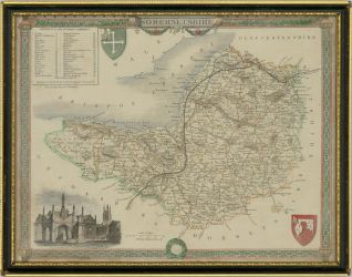
A fine hand coloured map of the county of Somerset. The map is embellished with a decorative border, a scale chart, an image of Glastonbury town in the lower left corner and several cartouches and coats of arms.
The map is presented in a Hogarth style frame with glazing.
On wove.
Condition
The condition is typical for a picture of this age including some discolouration and light foxing across the surface. The frame has a losses to three corners.
Size
17.3 x 22.9cm (6.8" x 9")Framed Size: 22.7 x 29.1cm (8.9" x 11.5")