The store will not work correctly when cookies are disabled.
We use cookies to make your experience better.To comply with the new e-Privacy directive, we need to ask for your consent to set the cookies. Learn more about our cookies policy.
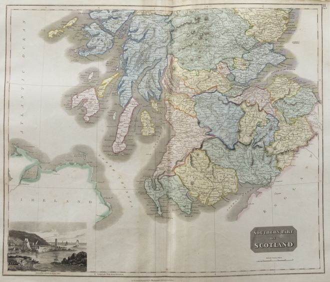
A fine engraved map of the southern part of Scotland from the second edition of John Thomson's 'New General Atlas' published in 1830. On paper.
Condition
The condition is typical for a picture of this age including some discolouration, foxing and small tears around the edges of the paper. Some creases to the tears at the upper edge. The map is folded in half, down the centre.
Size
52 x 60cm (20.5" x 23.6")
Collection Information
John Thomson (1777-c.1840) was a Scottish cartographer from Edinburgh, celebrated for his 'New General Atlas', originally published in 1817 by himself in Edinburgh, John Cumming in Dublin, and Baldwin, Cradock, and Joy in London. This collection of world maps is from the second edition, published in 1830.
The full title of the publication read as follows: 'A New General Atlas, consisting of a series of geographical designs, on various projections, exhibition the form and component parts of the Globe; and a collection of Maps and Charts, delineating the natural and political divisions of the empires, kingdoms and states in the World'.