The store will not work correctly when cookies are disabled.
We use cookies to make your experience better.To comply with the new e-Privacy directive, we need to ask for your consent to set the cookies. Learn more about our cookies policy.
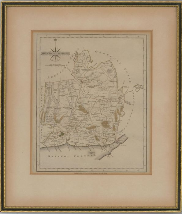
A fine engraved map of Monmouthshire by John Cary, published in 1787 in the 'New and Correct English Atlas'. Well-presented in a Hogarth-style frame, as shown. Unsigned dated and inscribed. On wove.
Condition
In good condition for a picture of this age. There is some surface discolouration and mount burn. The mount has some light surface discolouration. Minor scuffing to the corners of the frame.
Size
27.8 x 23.3cm (10.9" x 9.2")Framed Size: 40.4 x 34.7cm (15.9" x 13.7")
John Carey (c.1754 - 1835) is generally regarded as one of the greatest names in British cartography as his maps are unsurpassed for their quality, craftsmanship and detail.