Description
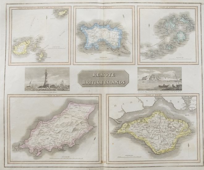
A fine engraved map of various British islands from the second edition of John Thomson's 'New General Atlas' published in 1830. This map shows the islands of Guernsey, Jersey, the Isles of Scilly, Isle of Mann and Isle of Wight. On paper.
Condition
The condition is typical for a picture of this age including some discolouration, foxing and small tears around the edges of the paper. The map is folded in half, down the centre. With plate lines.
Size
50 x 60cm (19.7" x 23.6")
Collection Information
John Thomson (1777-c.1840) was a Scottish cartographer from Edinburgh, celebrated for his 'New General Atlas', originally published in 1817 by himself in Edinburgh, John Cumming in Dublin, and Baldwin, Cradock, and Joy in London. This collection of world maps is from the second edition, published in 1830.
The full title of the publication read as follows: 'A New General Atlas, consisting of a series of geographical designs, on various projections, exhibition the form and component parts of the Globe; and a collection of Maps and Charts, delineating the natural and political divisions of the empires, kingdoms and states in the World'.
See More Like This
For our full collection of John Thomson (1777-1840) artworks click here