The store will not work correctly when cookies are disabled.
We use cookies to make your experience better.To comply with the new e-Privacy directive, we need to ask for your consent to set the cookies. Learn more about our cookies policy.
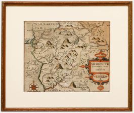
A very fine survival of an original 1610 engraved map of the county of Wiltshire, England, with original hand colouring and wash, by Jodocus Hondius (1563-1612) after John Speed (1551-1629). Published by John Sudbury and George Humble for John Speed's 'The Theatre of the Empire of Great Britaine' atlas. These were the first maps to include boundaries for all the hundreds. The addition of town plans, vignette views and heraldic devices gave the maps far greater visual appeal, although the cartographical content was copied from Saxton or Norden. The Wiltshire map is one of the most attractive thanks to the view of Stonehenge. Inscribed 'Jodocus Hondius calavit Anno 1610' to the lower edge.
Well-presented in a gilt wooden frame and card mount, with glazing front and back, showing both sides of the page.
Inscribed and dated. On watermarked laid.
Condition
The condition is typical for a picture of this age including some discolouration, spot staining and surface dirt. There are several closed repaired tears, mainly along the lower edge and central fold. These can be seen on the reverse. The frame has some light wear, but is in very good condition overall.
Size
38.2 x 51cm (15" x 20.1")Framed Size: 50.3 x 62.5cm (19.8" x 24.6")