The store will not work correctly when cookies are disabled.
We use cookies to make your experience better.To comply with the new e-Privacy directive, we need to ask for your consent to set the cookies. Learn more about our cookies policy.
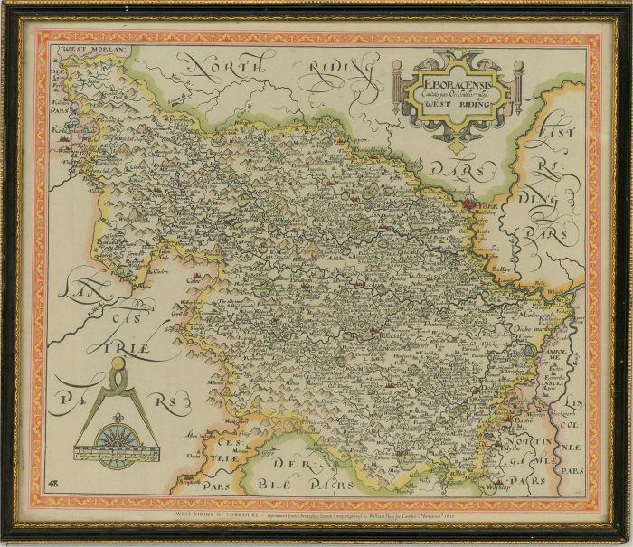
A lithograph after a map drawn by Christopher Saxton and engraved by William Hole for Camden's 'Britannia', first published in Latin in 1586 and translated into English in 1610, the object of which was to 'restore antiquity to Britain, and Britain to his antiquity'. A topographical and historical survey of all of Great Britain and Ireland, the work was a significant example of Renaissance scholarship. This reproduction copy depicts the map of West Riding in Yorkshire and was published by Edward Standford Limited. Numbered '48' to the lower-left corner. Presented glazed in a black and gilt-effect Hogarth-style frame. On wove.
Condition
Some scuffs to the edges and corners of the frame. Overall in very good condition.
Size
25.9 x 30.3cm (10.2" x 11.9")Framed Size: 32 x 37cm (12.6" x 14.6")